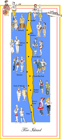
UNITED STATES
GEOLOGICAL SURVEY, FIRE ISLAND NATIONAL SEASHORE AND COASTAL CAROLINA
UNIVERSITY JOIN TO STUDY SEDIMENT MOVEMENT ON THE BEACH AND OFFSHORE OF FIRE
ISLAND
In early September a group quietly moved into their two week
headquarters in Kismet from which they left everyday at 6AM to pursue their
study.
The Team:
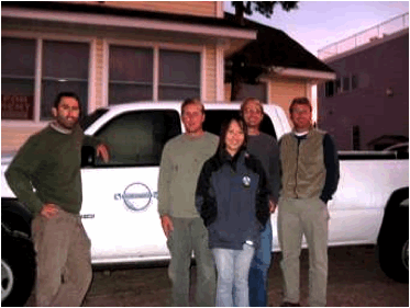
Left to right: Jeff Marshall, Clay McCoy, Shinobu Okano, Rich Viso,
and Jamie Phillips.
Clay McCoy, PhD, Senior Research Scientist, manage BERM program (Beach
Erosion, Research, and Monitoring) at CCU and conducted surfzone survey in this
project
Rich Viso, PhD, Assistant Director, Center for Marine and Wetland
Studies, CCU, manage multibeam data collection (offshore work in larger boat)
for this project
Captain Jamie
Phillips, Project Manager, boat captain
Jeff Marshall, Chief Hydrographer, oversees data collection and
processing
Shinobu Okano, Hydrographic Technician, data collection and processing
Reason for study:
This is a joint project with the United States Geological
Survey, Fire Island National Seashore, and Coastal Carolina University to study
sediment movement on the beach and offshore of Fire Island . We were up for 2 weeks to map the seafloor in two
sites: Lighthouse and Watch Hill. Data will be presented at
professional meetings and published in journals and will be utilized by coastal
managers of Fire Island. Below is some verbiage from the proposal we
submitted.
The Goal:
This study is designed to provide first-of-its kind data on
the nearshore bathymetry (0 – 10m water depth) within two sites along
FIIS, to begin to address the issues of onshore/offshore transport of sand to
and from the beach and its impact on beach erosion. It builds on the initial
pilot project completed in September 2007 using only single beam instrumentation. Here
is the goal of the 2007 data and the additional work conducted in 2009 was to
expand the work from the very nearshore areas (<1/2 mile to about 3 miles
offshore)
More Reasons for the Study:
The data collection effort will complement ongoing studies of
mapping changes on the beach, and the data derived from both analyses can be
combined to provide a topographic/bathymetric surface (maps). These data, in
turn, can be combined with older, existing bathymetric data collected further
offshore to provide the necessary foundation for modeling impacts of storm
waves. This will help to provide
information on how the removal of material (sand) from the proposed borrow
sites (borrow sites are locations sand is taken for renourishment and
placed on the beach) may alter wave
patterns, and ultimately impact beach (increase or decrease erosion rates)
Clay McCoy, PhD
Coastal Processes Specialist
Coastal Carolina University
South Carolina Sea Grant Extension Program
cmccoy@coastal.edu